 |
CIA climate change in 2008, Report of experts:
Wed, 19 Mar 2008 11:16:31 EST
Despite record snowfall and low temperatures around the world, climate experts forecast that 2008 may rank among the top 10 years since weather records ...read more
Green Tip of the week
Eat your leftovers! Wasting food is about more than just wasting money—it's also about wasting all the land resources that produce it. read more
DNA studies suggest that all humans today descend from a group in Africa 60,000 years ago. Follow the journey from them to you, as written in your genes. read more
Sunday December 12, 2004
Fifteen hundred people already live on a 465 acre island called Hulhumale, a brand-new island being built by the government of the Maldives to ease overcrowding. The government hopes to move about 45,000 people of the country's 300,000 residents over the next 15 years to this artificial island built on a lagoon. The creation of Hulhumale began in 1997.
read more
|
|
|
- Water Bodies(Rivers/Oceans)
- Land Masses
- Forest Regions
- Mountain Regions
- Deserts
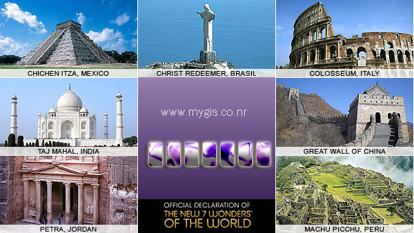
- 7 Wonders of World
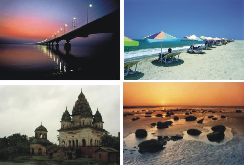
- Tourism Info.
- Usefull Links
EARTH'S OCEANS
 Oceans cover about 70% of the Earth's surface. The oceans contain roughly 97% of the Earth's water supply. Oceans cover about 70% of the Earth's surface. The oceans contain roughly 97% of the Earth's water supply.
The oceans of Earth are unique in our Solar System. No other planet in our Solar System has liquid water (although recent finds on Mars indicate that Mars may have had some liquid water in the recent past). Life on Earth originated in the seas, and the oceans continue to be home to an incredibly diverse web of life.
The oceans of Earth serve many functions, especially affecting the weather and temperature. They moderate the Earth's temperature by absorbing incoming solar radiation (stored as heat energy). The always-moving ocean currents distribute this heat energy around the globe. This heats the land and air during winter and cools it during summer.
THE OCEANS
The Earth's oceans are all connected to one another. Until the year 2000, there were four recognized oceans: the Pacific, Atlantic, Indian, and Arctic. In the Spring of 2000, the International Hydrographic Organization delimited a new ocean, the Southern Ocean (it surrounds Antarctica and extends to 60 degrees latitude).
There are also many seas (smaller branches of an ocean); seas are often partly enclosed by land. The largest seas are the South China Sea, the Caribbean Sea, and the Mediterranean Sea.
| Ocean |
Area (square miles) |
Average Depth (ft) |
Deepest depth (ft) |
| Pacific Ocean |
64,186,000 |
15,215 |
Mariana Trench, 36,200 ft deep |
| Atlantic Ocean |
33,420,000 |
12,881 |
Puerto Rico Trench, 28,231 ft deep |
| Indian Ocean |
28,350,000 |
13,002 |
Java Trench, 25,344 ft deep |
| Southern Ocean |
7,848,300 sq. miles (20.327 million sq km ) |
13,100 - 16,400 ft deep (4,000 to 5,000 meters) |
the southern end of the South Sandwich Trench, 23,736 ft (7,235 m) deep |
| Arctic Ocean |
5,106,000 |
3,953 |
Eurasia Basin, 17,881 ft deep |
RIVERS OF WORLD
Amazon
Amazon River
The Amazon River
Map of Amazon
Map of the Amazon River
Chang Jiang (Yangtze River)
Chang Jiang
The Yangtze River
Great Wall Across the Yangtze
This PBS special explores the Yangtze - the third largest river in the world that spans across China. Learn about the river's significance and the controversy that surrounds it.
Tourist map of the Yangtze River
Digital Photo Gallery: Yangtze River
Map of Chang Jiang
Danube
Danube
Map of Danube
Euphrates
Euphrates
Euphrates River History
Map of the Euphrates River
Ganges
The Ganga Basin Includes information about sources and tributaries, dams, pollution, and the river in Hindu myth.
Ganges River
Map of Ganges
Huang He (Yellow River)
Yellow River Home Page History, watershed information, and sediment control info.
Yellow River
Map of Huang He
Indus
Indus River
Map of Indus River
Mackenzie
Mekong
Mekong
Map of Mekong
Mississippi
Old Man River Take a tour of the Mississippi River.
Map of the Mississippi River
Missouri
Missouri River Brief information about the pollution on the Missouri River (one of America's most endangered rivers).
Map of the Missouri River
Murray
Murray River
Murray River General history of the river.
Map of the Murray River
Nile
Nile
The Nile Information from the Encyclopedia of the Orient.
The Nile River
Map of the Nile
Ob
Ob River
Ob River, also Obi
Map of Ob
|
Continets
Area and population
The total land area of all continents is 148,647,000 km², or approximately 29.1% of earth's surface (510,065,600 km2).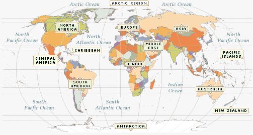
|
| Continent |
Area (km²) |
Approx. population |
Density
People per
square kilometre |
| Afro-Eurasia |
84,360,000 |
5,400,000,000 |
64.0 |
| Eurasia |
53,990,000 |
4,510,000,000 |
83.5 |
| Asia |
43,810,000 |
3,800,000,000 |
86.7 |
| America(s) |
42,330,000 |
886,000,000 |
20.9 |
| Africa |
30,370,000 |
890,000,000 |
29.3 |
| North America |
24,490,000 |
515,000,000 |
21.0 |
| South America |
17,840,000 |
371,000,000 |
20.8 |
| Antarctica |
13,720,000 |
1,000 |
0.00007 |
| Europe |
10,180,000 |
710,000,000 |
69.7 |
| Oceania |
9,010,000 |
33,552,994 |
3.7 |
| Australia-New Guinea |
8,500,000 |
30,000,000 |
3.5 |
| Australia mainland |
7,600,000 |
21,000,000 |
2.8 |
|
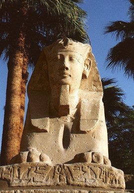
1.Africa(Land of the Serengeti sun)
 Population: 656,108,000 Population: 656,108,000
Density: 56.2 people every square mile
Main language groups: Arabic, Hausa, Amharic, Yoruba Oromo, Nguni, Igbo, Akan, Berber, and Malagasy
Principle Religions: Christianity, Islam, tribal religions, and Baha'i
Literacy: 46.9%
Largest Cities: Cairo, Egypt; Kinshasa, Zaire, and Alexandria, Egypt
Natural Features
Mountain Ranges: Ahaggar, Atlas, Cristal, Drakensburg, Mitumda, Muchinga, Ruwenzori, Tibesti, Virunga.
Largest Lakes: Victoria (26,828 square miles), Tanganyika (12,700 square miles), Nyasa (11,430 square miles)
Climate: Regions: very hot deserts, tropical wet and dry, Mediterranian, humid, subtropical, marine, warm temperate upland, and mountain.
Economy
Agricultural Products: Crops- bananas, beans, cashews, cassava, citrus, fruits,cocoa, coffee, corn, cotton, dates, maniac, millet, olives, palm nuts and oil, peanuts, plantains, pulses, rice, sorghum, sugarcane, sweet potatoes, yams. Livstock--camels, cattle, goats, pigs, poultry etc.
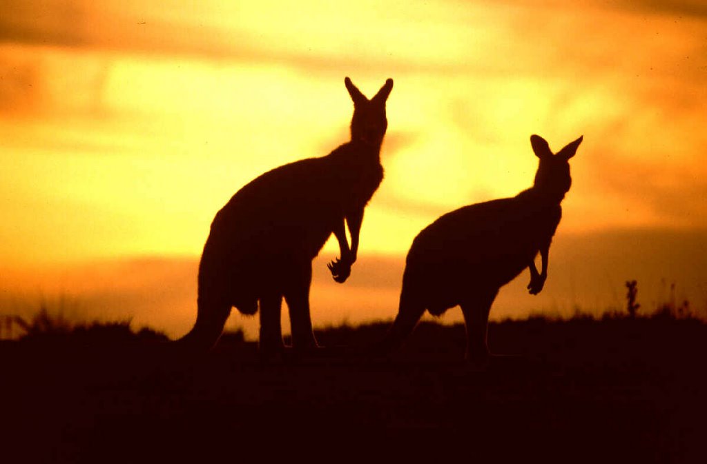
2. Australia(Island jewel)
Capital: Canberra
Area: 2,967,900 sq mi; 7,686,850 sq km
Perimeter: 17,365 miles (27,945 km)
Density: 6.2 people per square miles
Population: 18.287 million
Death rate per 1,000 people a year: 6.9
Birthrate per 1,000 people a year: 14.1
Marriage rate per 1,000 people a year: 6.0
Life Expectancy: 75.4 males; 81.1 females
Main Language: English
Major Religions: Roman Catholicism, Protestantism, and Orthodox Christianity
Major Cities: Sydney, Melbourne, Brisbane, Perth, Adelaide, Newcastle, and Canberra-Queanbeyan
Leading Exports: wheat, coal, gold, wool, and alumina.
3.Asia(The Eastern Frontier)
Population: 3,335,672,000
Density: 193.5 per square mile
Literacy: 65.5%
Birth Rate: 27 people a year per 1,000 people
Death Rate: 9.25 people a year per 1,000 people
Growth Rate: 1.8%
Main Languages: Chinese, Hindi, Bengali, Japanese, Punjabi, Javanese, Korean
Principal Religions: Hinduism, Islam, Buddhism, Christianity, Shintoism, Taoism, Zoroastrianism
Largest Cities: Seoul, Bombay, Jakarta, Tokyo, Shanghai
Consisting Countries
Asia is a continent that has been very important to the World. People have been living there for thousands of years. In fact, the first traces of civilization began in Mesopotamia, a part of Asia. Asia is the continent with the huge country of China. In the 15th and 16th century, a great monument in China was being built. It is called the Great Wall of China. The Great Wall is the only man made super structure that can be seen from space. It is also a monument of human advancement considering that it was built in times before our major technological ages.
4. Antarctica(Frigid Wasteland)
Area: 12 percent of the earth
Population: 0 (except for scientists who live there temporarily)
Climate:
Snowfall 2 inches in the middle and 20-40 inches on the coastlines
Wind speed at most is 200 mph
The coldest temperature is -126~Fahrenheit
The warmest temperature is 59 Fahrenheit along the Antarctic Peninsula
Monthly mean temperature range from -18"-F to 27"-F.
Terrain
*Sometimes massive ice shelves will break of glaciers and float away.
*Antarctica has the lowest mean elevation
*Only two percent of Antarctica is ice free.
5.Europe(A continent for kings)
POPULATION: 742,400,000
DENSITY: 183.0 persons per sq. mi
MAIN LANGUAGES: Russian, German, French, English, Italian, Ukrainian, Polish, Spanish, Romanian, Dutch, Serbo-Croatian
MAIN RELIGIONS: Roman Catholicism, Eastern Orthodoxy, Protestantism, Judaism
LARGEST CITIES: Moscow, London, Istanbul, St. Petersburg, Berlin
It is the land of old battlefields, kings, and fables. It can dazzle you beyond belief. Though it is the second smallest continent it has centuries of interesting history and has been home to some of the strongest nations of all time. It had power from the ancient times when the Greeks and Romans were making a name for themselves, to the great nations of the 1700's, Spain, France, and England. It has been the land of ancient empires, medieval kings, and two world wars. It is Europe.
|
|
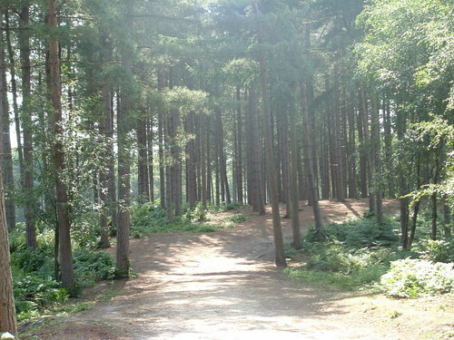
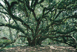
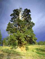
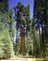
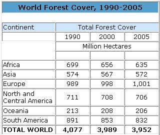
Forest Regions of world
A healthy planet needs healthy forests. Thriving forests regulate the
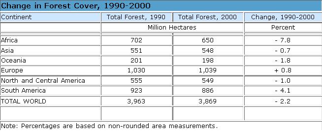
Water cycle and stabilize soils. Forests also help moderate climate by soaking up and storing carbon dioxide. In addition to these ecosystem services, forests provide habitat for diverse flora and fauna, offer cultural, spiritual, and recreational opportunities, and provide a variety of food, medicines, and wood. World Forest Cover, 1990-2005
Nearly 4 billion hectares of forest cover the earth’s surface, roughly 30 percent of its total land area. Though extensive, the world’s forests have shrunk by some 40 percent since agriculture began 11,000 years ago. Three quarters of this loss occurred in the last two centuries as land was cleared to make way for farms and to meet demand for wood.
Over the last five years, the world suffered a net loss of some 37 million hectares (91 million acres) of forest, according to data from the United Nations Food and Agriculture Organization. This number reflects the felling of 64.4 million hectares of trees and the planting or natural regeneration of 27.8 million hectares of new forest. Each year the world loses some 7.3 million hectares of forest, an area the size of Panama
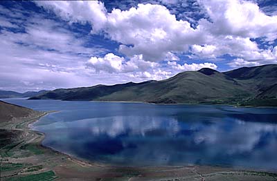
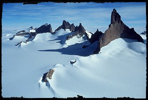
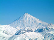
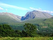
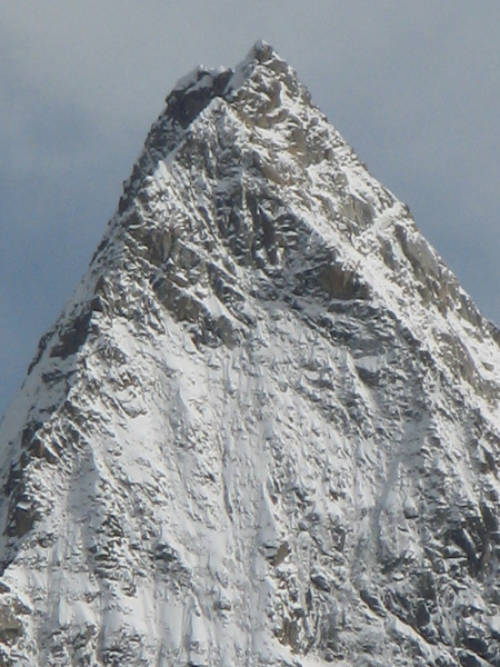
Mountain Regions of world
We are about to embark on a journey across the continents to learn about the mountain regions of the world.
Are there any mountains in Rhode Island?
The answer to that question is no. The highest landform in R.I. is Jerimoth Hill in the northwest corner in Foster, R.I. It is only 812 feet high so it doesn't qualify as a mountain.
A mountain is a landform that stands much higher than its surroundings usually larger than hills. They generally have steep slopes and sharp or slightly rounded edges. Geologists, scientists who study the earth, consider an elevated area a mountain only if it includes 2 or more zones of climate and plant life at different altitudes or heights. The climate often becomes cooler and wetter with increased elevation. In most parts of the world a mountain must rise 2,000 feet or 600 meters.
At Illustrating the Earth's Layers you can compare the layers of the earth to other things and get ideas about how to create your own model.
Here is another excellent site at which you can learn about the Layers of the Earth.
Large areas of the crust called plates move slowly around on the earth's surface. The oceans and continents ride on the plates. Long ago the plates were still joined. Their edges could still fit together like a jigsaw puzzle.
Volcanic mountains like Mt. St. Helen's in Washington form when molten rock from deep within the earth erupts and piles up on the surface. Volcanic mountains are mostly igneous rock which forms when hot molten rock cools and solidifies.
This is a photo of scenic, beautiful Mt. St. Helens before the eruption in 1980.
On May 18,1980, Mt. St. Helens sent 540,000 tons of ash into the atmosphere that was measurable for more than 900 miles to the east and trace amounts circled the earth for 10 days.
Life is now returning 20 years later.
This volcano has erupted several times since 1980. Fifty-seven people died in 1980 and it caused millions of dollars of damage. Hot ash and rocks started forest fires and melting snow resulting in floods and mud slides that washed away buildings, roads and bridges. It knocked down millions of trees and spread a thick layer of volcanic ash destroying crops and wildlife.
To learn more about Mt. St. Helens and other volcanoes go to Volcanoes
Hawaii is made up of 132 islands formed from volcanoes built up from the ocean floor. People live on 7 of the 8 largest islands. The other islands are too infertile and small to support human life.
Hawaii, the largest island, was formed by 5 volcanoes. Mauna Loa, and Kilauea are the only active volcanoes. Mauna Loa erupts at irregular times, and sometimes sends streams of fiery lava flowing down to the ocean. Kilauea erupts more frequently. A highway passes near the edge of the crater so it is sometimes called a "drive-in" volcano. Bubbling lava and fire fountains attract thousands of tourists every year. To learn more about these volcanoes, visit
Hawaii: Born of Fire
Here lava flows through the tube system to the sea. Click here to explore the fascinating most active volcano in the world - Kilauea
If you have any further questions about volcanoes there is a site where many questions have been asked of a volcanologist, or an expert on volcanoes. Become a volcano expert yourself by visiting Ask a Volcanologist
Fold mountains such as the Appalachian Mountains in the U.S. and the Alps in Europe form when 2 plates meet head on and the edges crumple. They are mainly sedimentary rocks such as limestone and shale, which form when pieces of rock, plant and animal sediments fall and settle to the bottom of the water and harden there. Heat and pressure then change the rock into metamorphic rocks such as marble and slate.
Fold Mountains
Many of the greatest mountain ranges of the world have formed because of enormous collisions between continents. The Appalachian Mountains in the Eastern United States were formed about 400 million years ago when North America and Africa collided.
The San Andreas Fault in California is created by the Pacific Plate grinding past the North American Plate. A fault is a fracture in the earth's crust in which the rocks on each side move in relation to each other. Here you can see the actual crack in the earth. It is visible for miles above ground. You can learn more about this fault at San Andreas Fault
The Black Hills of South Dakota and Wyoming, and the Adirondack Mountains of New York are low mountains that were formed when the crust was heaved upward without folding or faulting into a rounded dome. These are called dome mountains. Dome mountains are much higher in elevation than the surrounding land and because of this erosion occurs at a very fast rate.
A few erosion mountains such as the Catskill Mountains in New York result from the erosion of a thick pile of sedimentary rock. This type of a mountain is all that remains of a plateau after rivers or glaciers erode the plateau to form peaks and valleys.
Erosion means to wear away. Mountains are eroded by the effects of wind, rain, ice, and snow.
To see the effects of erosion with the help of lightning strikes go to Arches National Park.
Do you think that this rock will remain balanced here forever? What may happen over time?
Where in the world are the mountain regions?
Mountains cover about one fifth of the earth's surface. Australia and Africa have very few mountains, but Asia has huge areas of mountainous land.
There are vast underwater mountain chains that form part of the ocean floor. Hawaii is the topmost part of an underwater volcano. If you measured from the ocean floor it would be even higher than the world's highest mountain at 29,520 feet!
At World Roof you can visit the high points of the world. There is a list of the high points with the name of the country, summit, height, and location. There is also the latitude and longitude with numbers based on Expedia Map's name server. Negatives represent southern latitudes and western longitudes. This is an excellent site for a Web quest search.
This graphic will help to review longitude and latitude.
At Peakware World Relief Maps you can zoom into any region of the world, range, or peak to identify its name just by clicking on the topographical map.
At World Atlas- The List you can find the tallest, largest, deepest anything you need to know. There is a comprehensive list of facts about everything!
TOP 10 TALLEST MOUNTAINS
(By Size)
Mount Everest 8850m (29035 ft) Nepal
Qogir (K2) 8611m (28250 ft) India (Kashmir)
Kangchenjunga 8586m (28169 ft) Nepal
Lhotse 8501m (27920 ft) Nepal
Makalu I 8462m (27765 ft) Nepal
Cho Oyu 8201m (26906 ft) Nepal
Dhaulagiri 8167m (26794 ft) Nepal
Manaslu I 8156m (26758 ft) Nepal
Nanga Parbat 8125m (26658 ft) Pakistan
Annapurna I 8091m (26545 ft) Nepal
TALLEST MOUNTAINS
(On Each Continent)
Mount Everest 8850m (29035 ft) Asia
Aconcagua 6959m (22831 ft) S. America
Mount McKinley 6194m (20320 ft) N. America
Mount Kilimanjaro 5963m (19563 ft) Africa
Mount Elbrus 5633m (18481 ft) Europe
Mount Willhelm 4509m (14789 ft) Oceania
Vinson Massif 4897m (16066 ft) Antarctica
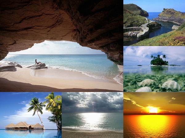
| Desert Regions of world |
|
 |
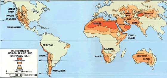 |
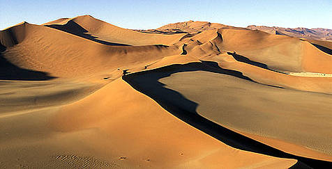
World Deserts
The 12 Major Deserts
There are 12 distinct deserts around the world, at least one on every continent except Europe and Antarctica.
All together, they take up about one fifth of the earth's surface.
The deserts of the world tend to form two bands around the globe.
- The Takla Makan-Gobi in China
- The Turkestan in Southern Russia
- India's Thar
- The Iranian, Arabian and Saharan
- The North American Desert
All occur near the Tropic of Cancer in the Northern Hemisphere. Their Southern Hemisphere counterparts are:
- The Kalahari and Namib in Africa
- The Patagonian and Atacama in South America
- The Australian
- All occur along the Tropic of Capricorn.
- Each great desert has many divisions and sub-divisions.
The North American Desert is one of the 12 global Deserts.
Major Deserts of the World |
Name |
Type of Desert |
Surface Area |
Location |
Antarctic |
Polar |
5.5 million mi² |
Antarctica |
Arctic |
Polar |
5.4 million mi² |
Alaska, Canada, Greenland, Iceland, Norway,
Sweden, Finland, Russia |
Sahara (map) |
Subtropical |
3.5 million mi² |
Northern Africa |
Arabian (map) |
Subtropical |
1 million mi² |
Arabian Peninsula |
Gobi |
Cold Winter |
500,000 mi² |
China and Mongolia |
Patagonian (map) |
Cold Winter |
260,000 mi² |
Argentina |
Great Victoria |
Subtropical |
250,000 mi² |
Australia |
Kalahari (map) |
Subtropical |
220,000 mi² |
South Africa, Botswana, Namibia |
Great Basin (map) |
Cold Winter |
190,000 mi² |
United States |
Thar (map) |
Subtropical |
175,000 mi² |
India, Pakistan |
Chihuahuan (map) |
Subtropical |
175,000 mi² |
Mexico |
Great Sandy (map) |
Subtropical |
150,000 mi² |
Australia |
Kara-Kum (map) |
Cold Winter |
135,000 mi² |
Uzbekistan, Turkmenistan |
Colorado Plateau |
Cold Winter |
130,000 mi² |
United States |
Gibson |
Subtropical |
120,000 mi² |
Australia |
Sonoran (map) |
Subtropical |
120,000 mi² |
United States, Mexico |
Kyzyl-Kum |
Cold Winter |
115,000 mi² |
Uzbekistan, Turkmenistan, Kazakhstan |
Taklamakan (map) |
Cold Winter |
105,000 mi² |
China |
Iranian |
Cold Winter |
100,000 mi² |
Iran |
Simpson (map) |
Subtropical |
56,000 mi² |
Australia |
Mojave (map) |
Subtropical |
54,000 mi² |
United States |
Atacama (map) |
Cool Coastal |
54,000 mi² |
Chile |
Namib (map) |
Cool Coastal |
13,000 mi² |
Angola, Namibia, South Africa |
World's top tourist spots
(international tourist arrivals)
2006
rank |
Country |
Arrivals (millions) |
Percent
change
2005/2004 |
Percent
change
2006/2005 |
| 2005 |
2006 |
| 1. |
France |
75.9 |
79.1 |
1.0% |
4.2% |
| 2. |
Spain |
55.9 |
58.5 |
6.6 |
4.5 |
| 3. |
United States |
49.2 |
51.1 |
6.8 |
3.8 |
| 4. |
China |
46.8 |
49.6 |
12.1 |
6.0 |
| 5. |
Italy |
36.5 |
41.1 |
-1.5 |
12.4 |
| 6. |
United Kingdom |
28.0 |
30.7 |
9.2 |
9.3 |
| 7. |
Germany |
21.5 |
23.6 |
6.8 |
9.6 |
| 8. |
Mexico |
21.9 |
21.4 |
6.3 |
-2.6 |
| 9. |
Austria |
20.0 |
20.3 |
3.0 |
1.5 |
| 10. |
Russian Federation |
19.9 |
20.2 |
0.2 |
1.3 |
|
|
|

